Nearby Essentials
No essentials listed yet.
Some listings may be paid partnerships.
Know a useful stop near this trail? Suggest a business
Turtlehead Peak Trail has a dedicated following among RRC NCA hikers thanks to its strenuous challenge and sweeping summit views. Of all the sanctioned routes in the park, turtlehead-peak-trail is widely considered the most demanding—though still modest compared to Mount Wilson. If you’re looking for a serious workout with one of the biggest payoffs in Red Rock Canyon, this is it.
Trailhead & Parking
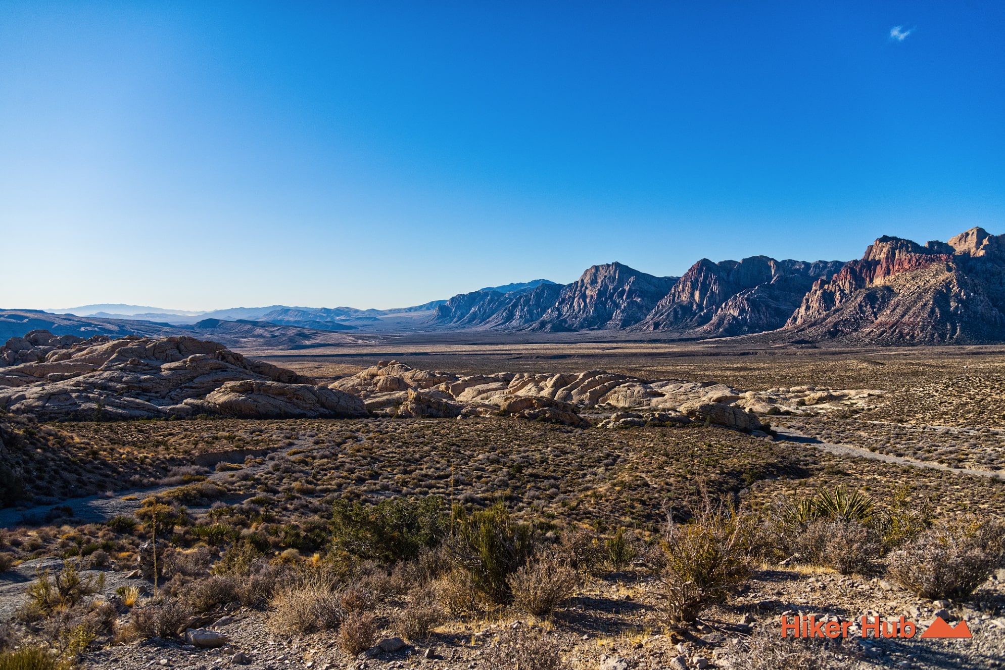
Access the turtlehead-peak-trail from the Sandstone Quarry parking lot—the same lot used for Calico Tanks. From the lot, Calico Tanks heads right, while Turtlehead Peak branches left. Despite the often-packed parking area, Turtlehead sees far fewer hikers than Calico Tanks. Still, this lot fills quickly—especially on weekends and holidays—so arrive early (6–8 a.m.) or allow at least four hours before sunset.
Views from the Summit
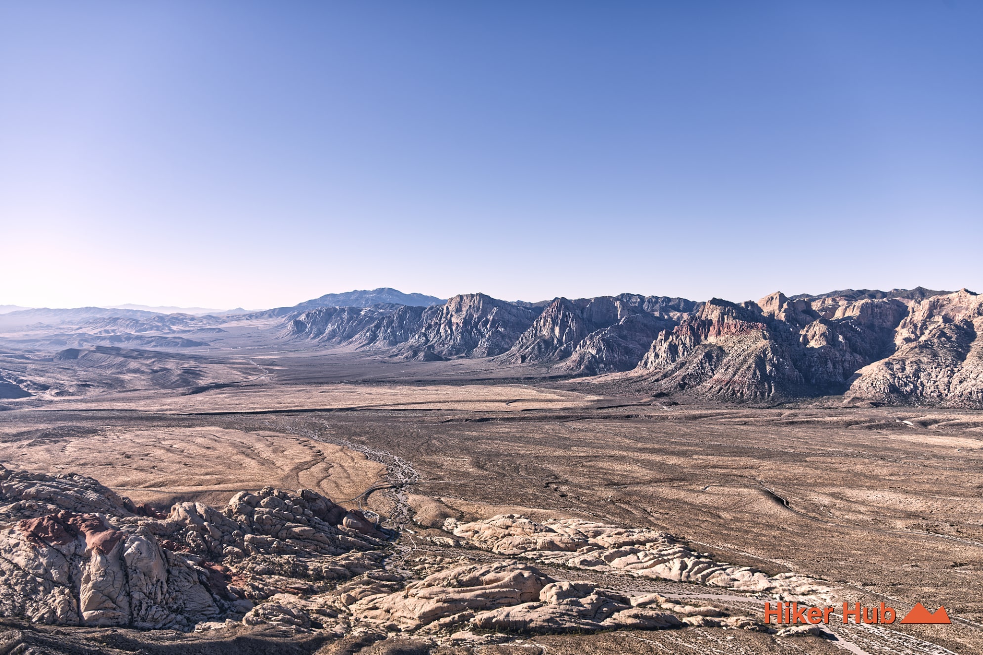
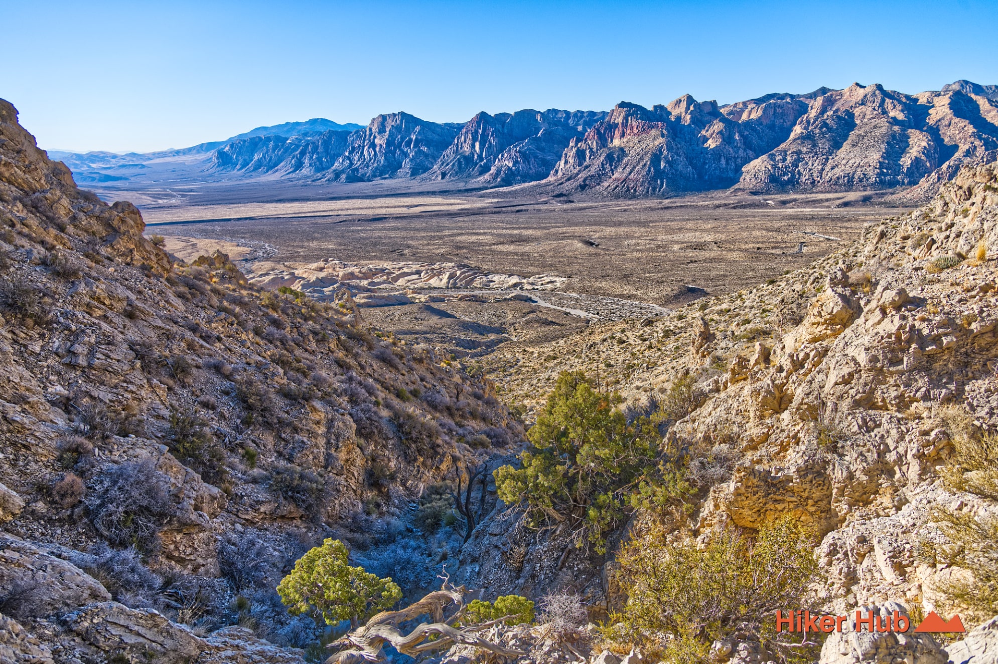
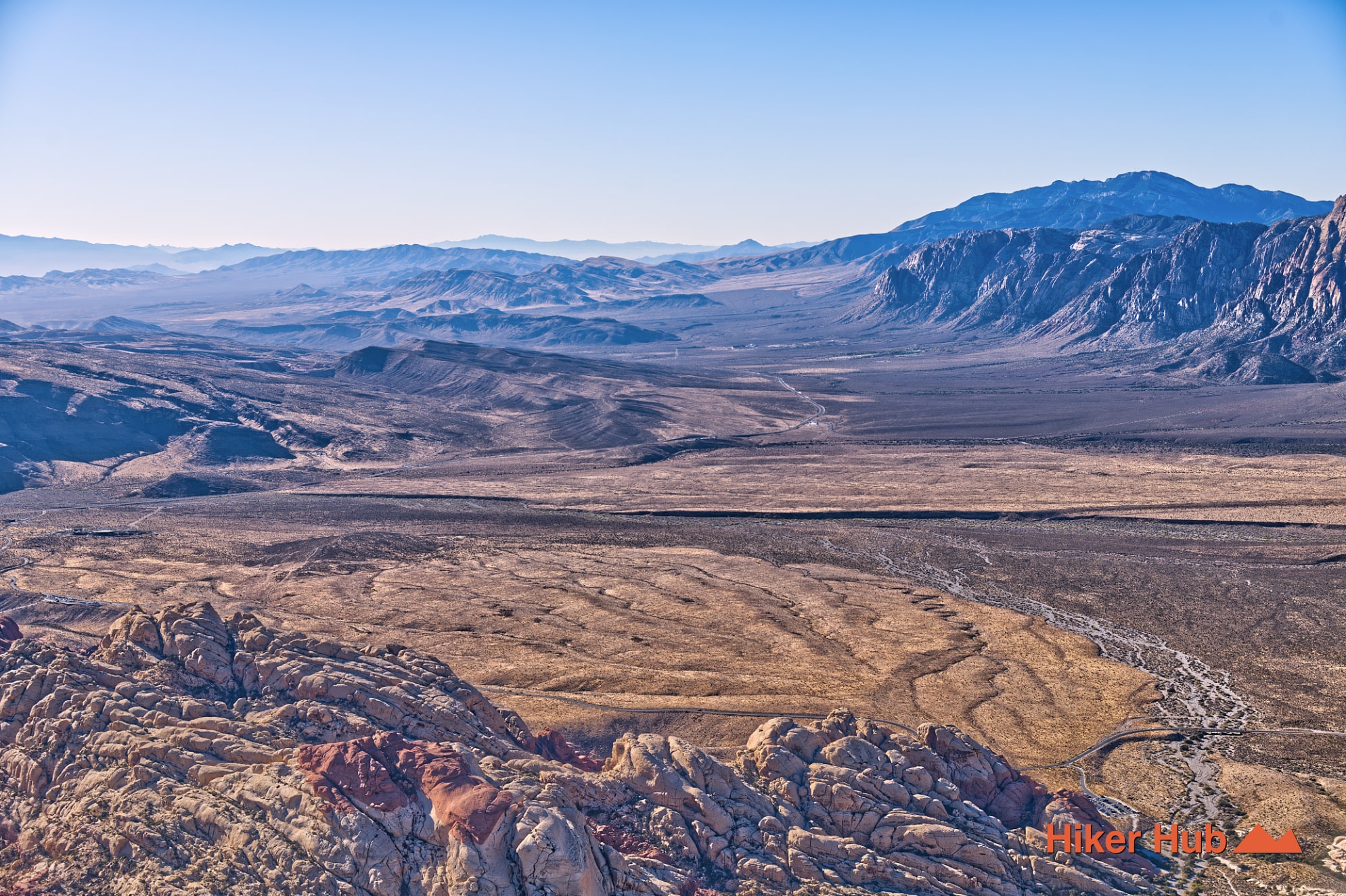
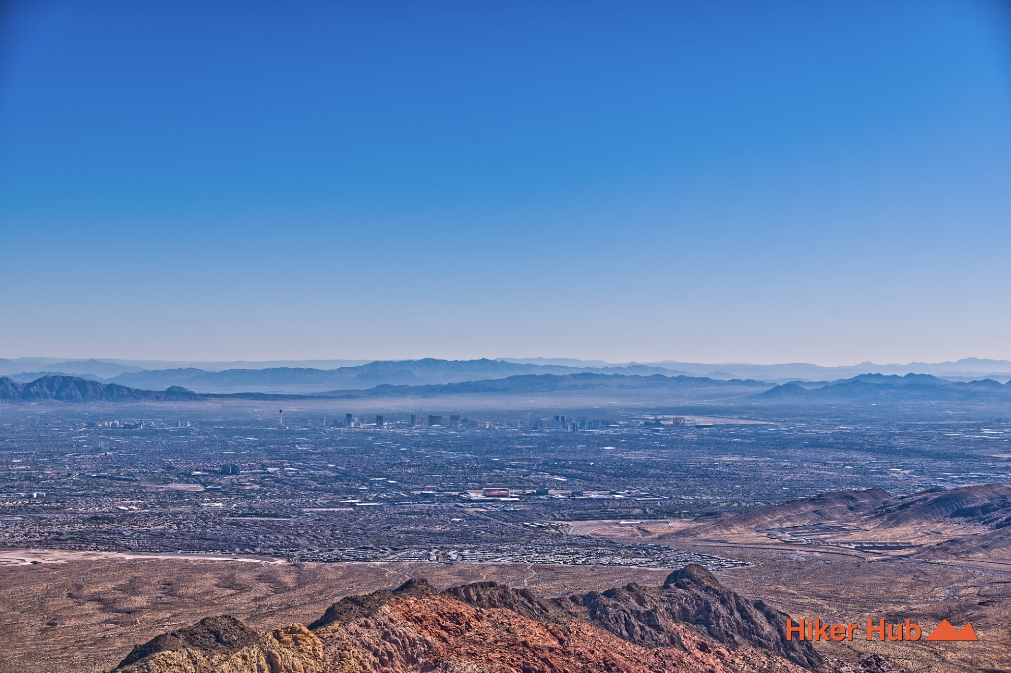
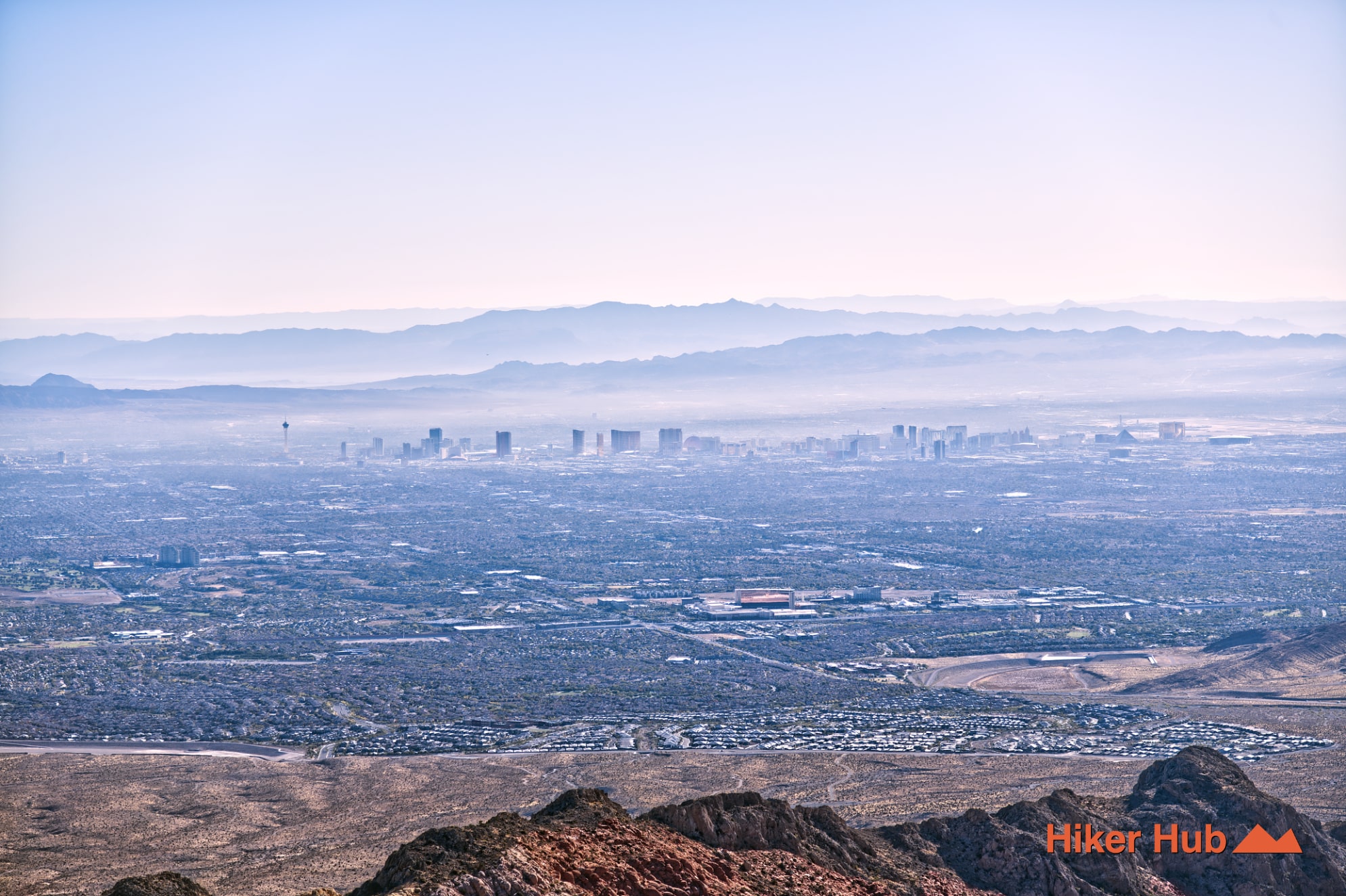
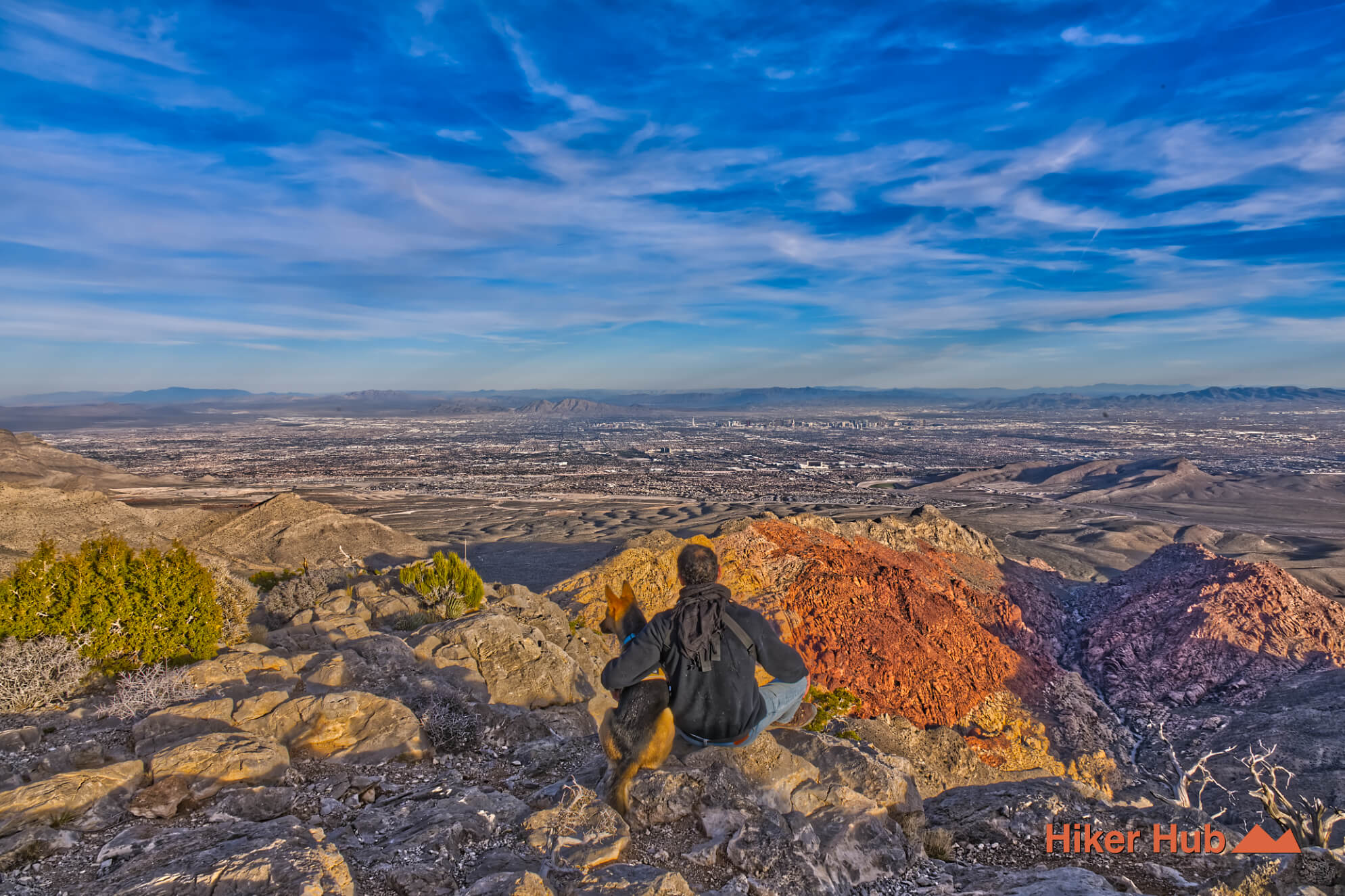
The summit rises above 6,300 feet and offers a panoramic sweep stretching from Henderson to Nellis Air Force Base, with the Las Vegas Strip in between. Red Rock Casino sits just right of center in the skyline, while Kraft Mountain lies directly below the ledge. Blue Diamond appears far to the right. Surrounding you are the Calico Hills and dramatic sandstone formations, layered over early–mid Paleozoic limestone and dolomite, some thrust over Jurassic Aztec Sandstone.
Wind at the summit can be intense. On blustery days, gusts are powerful enough to destabilize hikers. Winter hikes—especially in January—can bring bone-chilling cold and numb fingers. Otherwise, most of the year offers manageable desert conditions.
Trail Breakdown
The hike is commonly divided into four distinct sections:
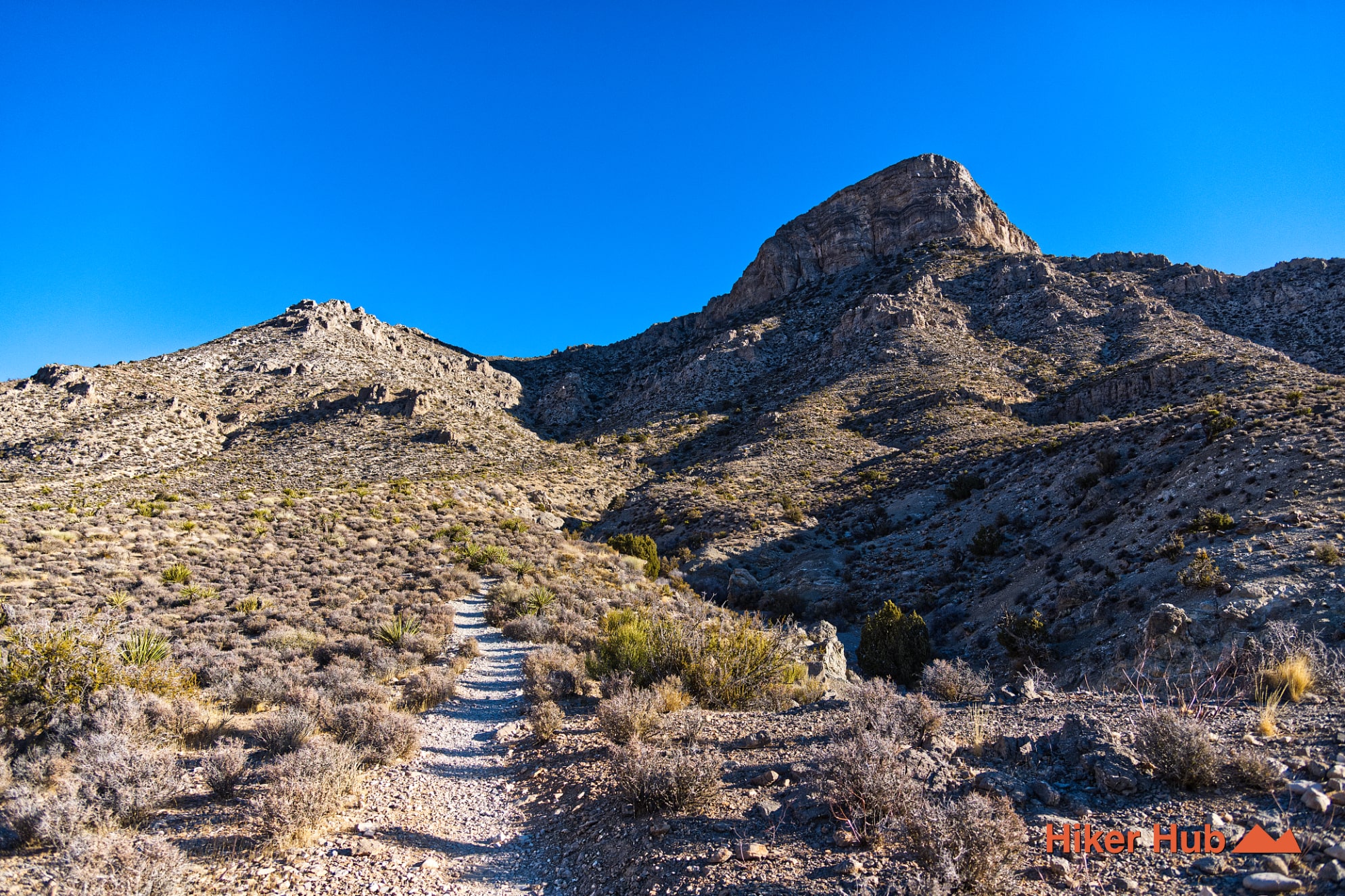
- Section 1: The entry through a wash with gradual incline before the peak fully reveals itself.
- Section 2: A sustained climb along a clearly defined path. Looking back reveals beautiful early-morning or late-afternoon light across the valley.
- Section 3: A scattered, zig-zagging stretch marked intermittently by fading white dots and trail markers. This leads to the “cat walk,” with valleys visible on either side.
- Section 4: The final ascent to the summit. Route-finding can be tricky. Before climbing, note visual landmarks on adjacent mountains to help guide your descent.
Difficulty & Descent
The third and fourth sections of the turtlehead-peak-trail are steep and strenuous. Descending can be just as challenging as the climb. Many hikers follow the crest briefly before heading down, as this side is often easier to track back to the cat walk.
Average round-trip time is 3–4 hours, though strong hikers may complete it in just over three. Be mindful of daylight—navigating this trail after dark without a headlamp means complete desert darkness. Plan accordingly.
Why Hike Turtlehead Peak Trail
This is one of the most rewarding summit hikes in Red Rock Canyon. The effort is real, the terrain demanding, but the views and sense of accomplishment are unmatched. Prepare properly, respect the elevation and wind, and the turtlehead-peak-trail will deliver an unforgettable desert summit experience.
Slug: turtlehead-peak-trail-red-rock-canyon. Keywords: Turtlehead Peak Trail, turtlehead-peak-trail, Turtlehead Peak Red Rock Canyon, strenuous hikes Red Rock Canyon, hardest trail Red Rock Canyon, Sandstone Quarry trailhead, summit hikes Las Vegas.
Last updated: February 4, 2026