Water carry
3L Hydration Pack
Useful for exposed desert routes where one small bottle is not enough.
View hydration packs3.83 miles • Easy • Trail
Conditions, access, and regulations can change. Always verify current information and assess safety before visiting.
Offline maps coming soon. Be first to access downloadable routes.
Some listings may be paid partnerships.
Know a useful stop near this trail? Suggest a business
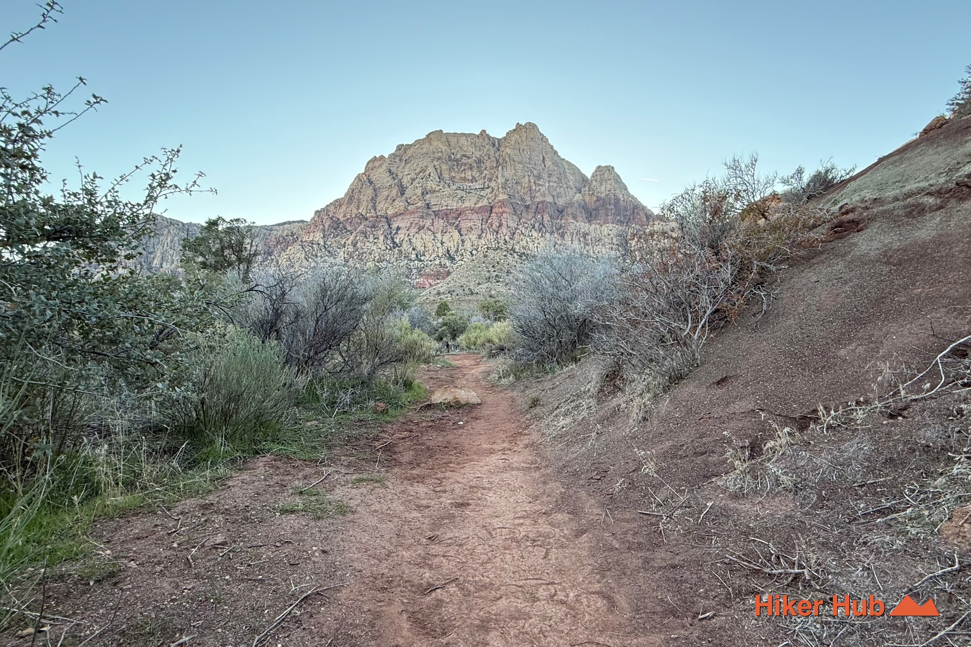
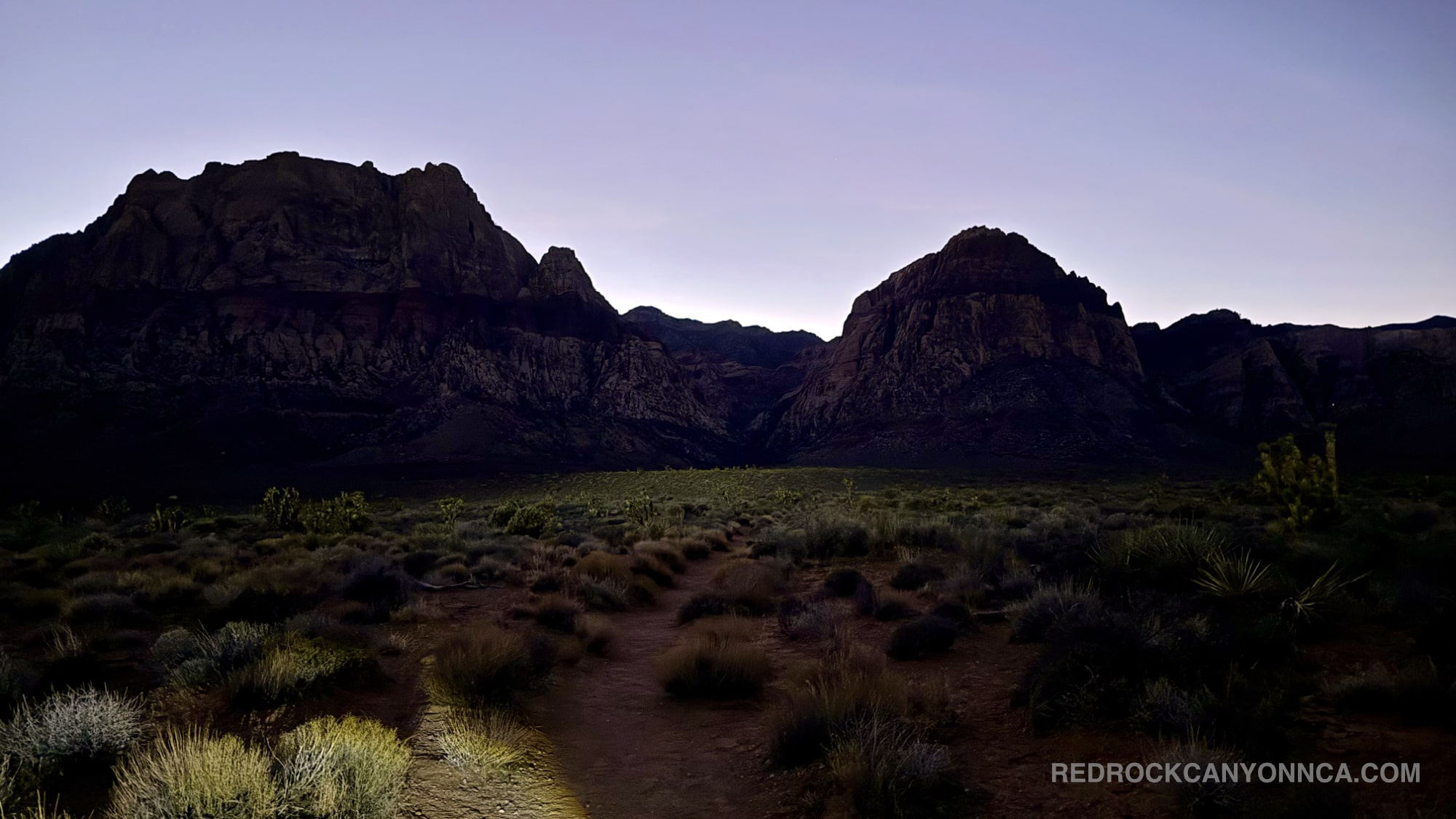
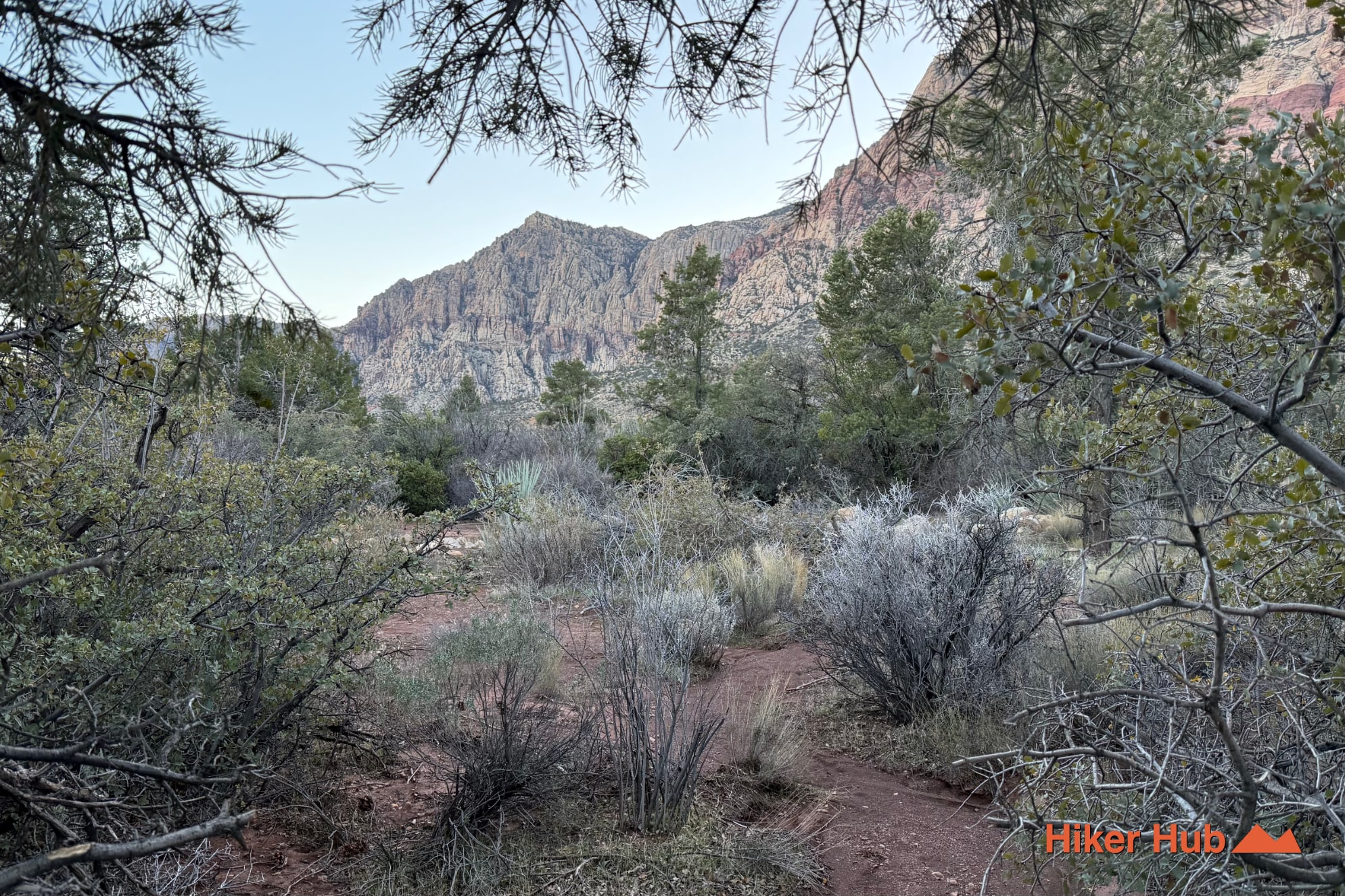
This one-of-a-kind route begins at Middle Oak Creek and immediately veers onto a series of unmarked, lightly traveled paths that descend into the lower desert floor. These unsanctioned corridors weave across deceptively flat terrain that is actually composed of gentle, rolling hills—landforms that explain how wildlife in Red Rock Canyon Las Vegas appears and disappears so abruptly. Objects that seem close vanish behind low crests, and animals standing just a few hundred feet away can be completely hidden in the folds of the desert. Following these subtle rises and dips provides a new perspective on the landscape and offers a clearer understanding of this mysterious region—the Burro Country Loop.
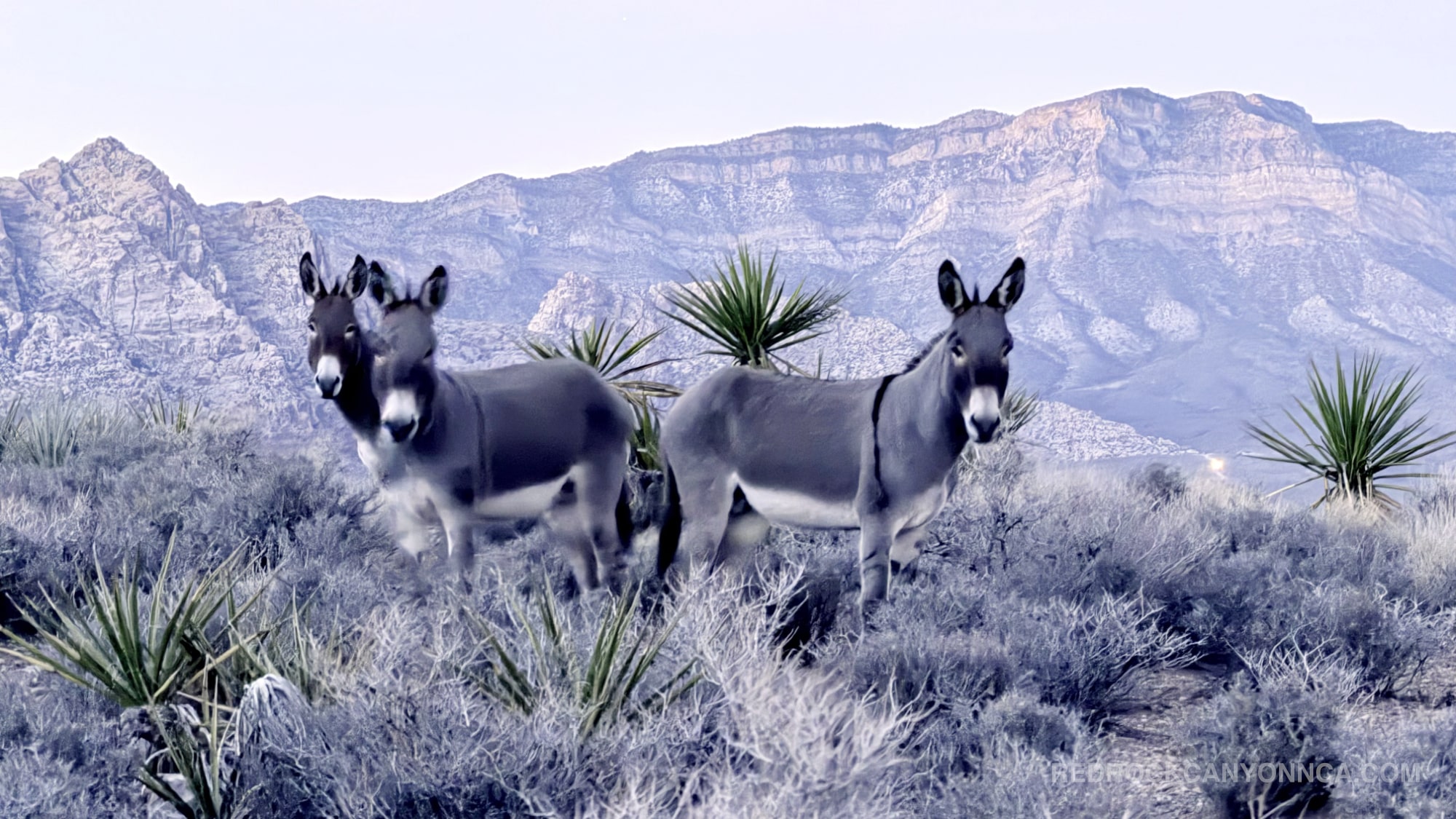
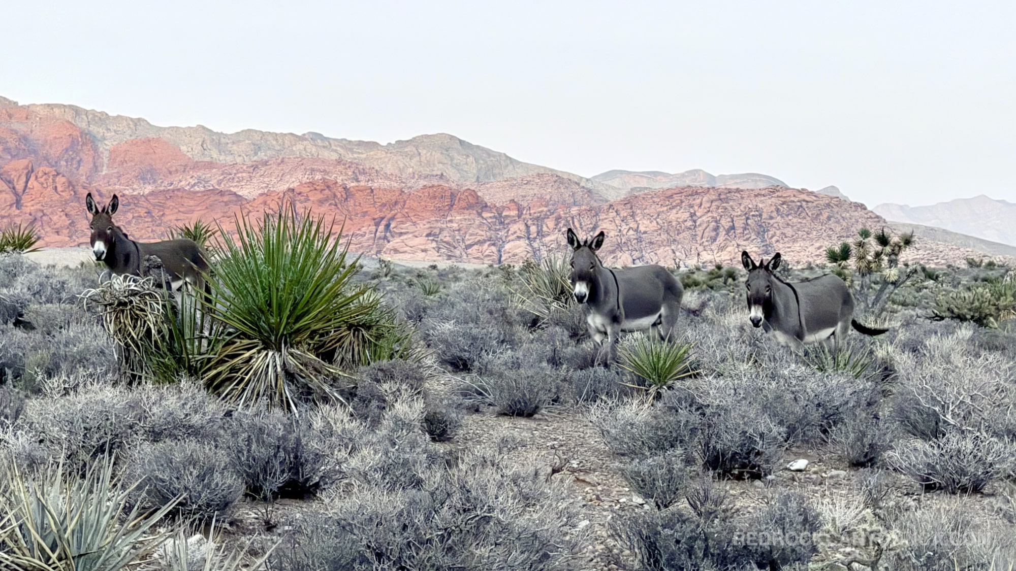
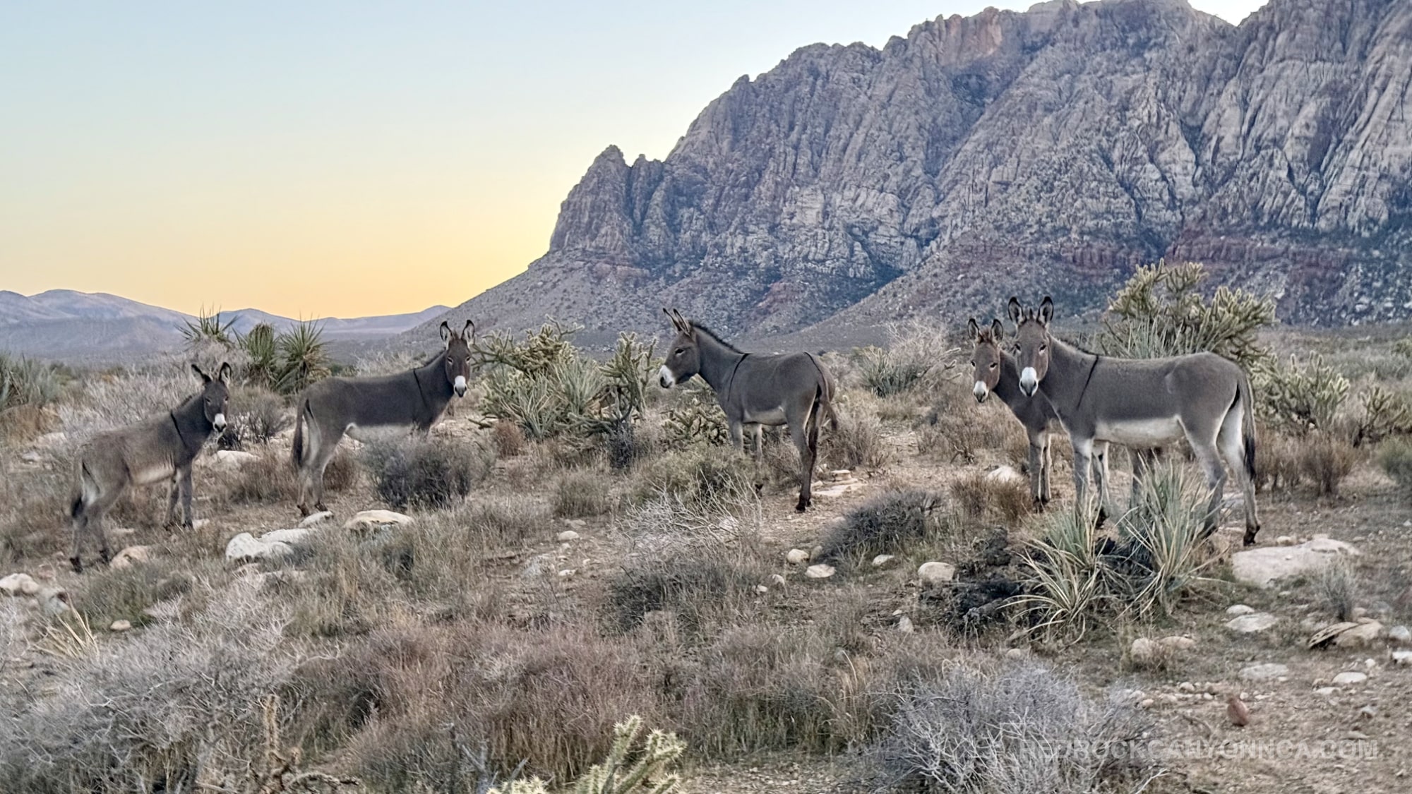
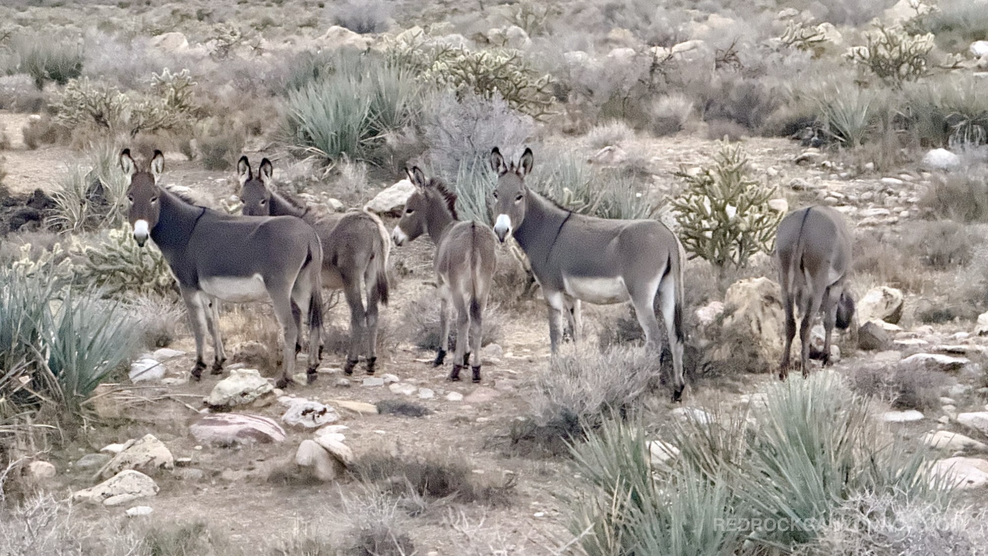
Said 'pockets'—full of juniper clusters, willows, and desert shrubs nourished by intermittent runoff—create natural wildlife corridors. It's through these hidden basins that multiple herds of burros have been spotted (among other places), quietly grazing before fading back into the rolling desert. Few visitors use these paths, making the experience feel wild, with wildlife behavior unfolding naturally rather than from a distance.
The burros of Red Rock Canyon National Conservation Area most hikers encounter today are descendants of animals introduced in the late 1800s and early 1900s by miners, ranchers, and early settlers. When mining diminished and ranches closed, many of these burros were released or escaped into the wild. Over generations, they became fully adapted to the Mojave Desert, behaving more like native wildlife than domestic animals. They travel long distances, form small family bands, and rely on the region’s washes, springs, and desert vegetation for survival.
In the ecosystem, burros occupy a curious niche. While not native, they have integrated into Red Rock Canyon’s natural rhythms—moving along the same drainages used by deer, coyotes, and smaller mammals. They often graze in the early morning or late afternoon, using the rolling topography to stay partially concealed. Their presence can shape local vegetation patterns, influence the distribution of water sources, and create pathways through dense brush that other animals later use. They’re also remarkably observant, often spotting hikers long before being seen themselves.
This route through the lower desert is one of the best ways to understand how wildlife moves through Red Rock Canyon. Exploring these unmarked paths not only reveals the subtle beauty of the rolling terrain but also offers a rare opportunity to encounter burros and deer in their natural patterns—appearing suddenly, disappearing silently, and moving effortlessly across this burro country loop most visitors never truly see. If you're looking for hiking in Las Vegas...something unique; embark on this adventure mid-late afternoon;
Recommended gear
Gear picks are matched to this route using distance, difficulty, terrain, and desert conditions.
Disclosure: some links may be affiliate links. Red Rock Hiker Hub may earn a commission at no extra cost to you.
Water carry
Useful for exposed desert routes where one small bottle is not enough.
View hydration packsShade
Simple shade matters on open desert terrain, sandstone slabs, and long approaches.
View hiking hatsSun protection
A lightweight sun layer is one of the most useful pieces of gear for Red Rock exposure.
View sun hoodiesFooting
Better traction helps on loose gravel, sandstone, rocky washes, and steeper trails.
View trail shoesSkin protection
Small, easy to carry, and useful on nearly every Southern Nevada trail.
View SPF essentialsSafety
Worth carrying for cactus spines, scrapes, blisters, and minor trail injuries.
View first aid kits