Water carry
3L Hydration Pack
Useful for exposed desert routes where one small bottle is not enough.
View hydration packs.92 miles • Moderate • Trail
Conditions, access, and regulations can change. Always verify current information and assess safety before visiting.
Offline maps coming soon. Be first to access downloadable routes.
Some listings may be paid partnerships.
Know a useful stop near this trail? Suggest a business
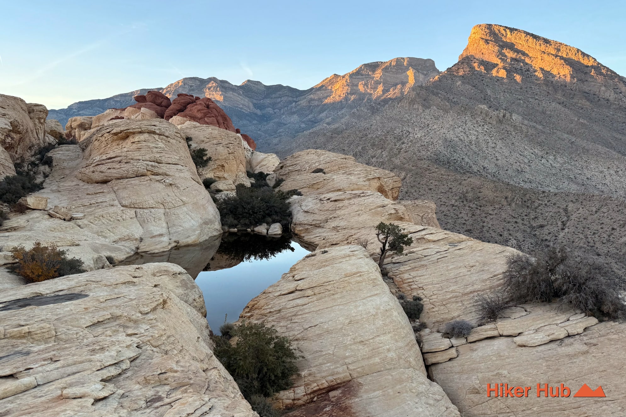
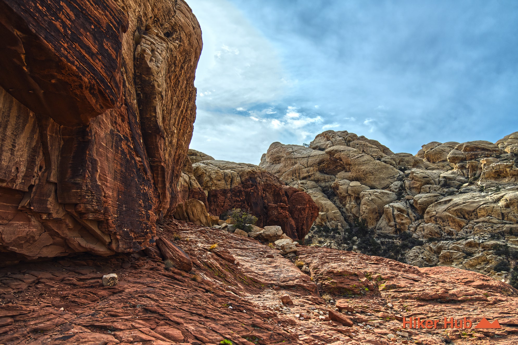
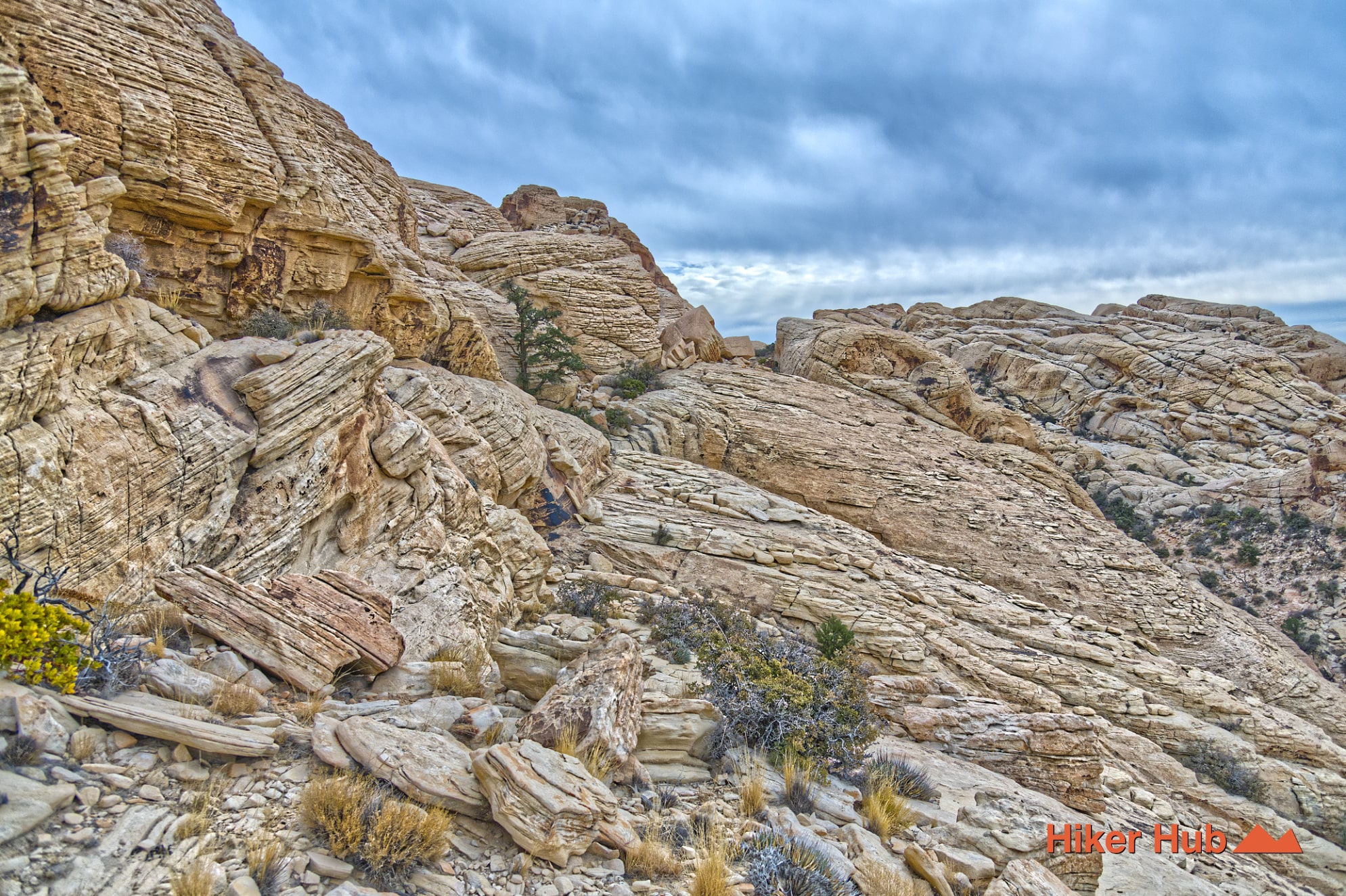
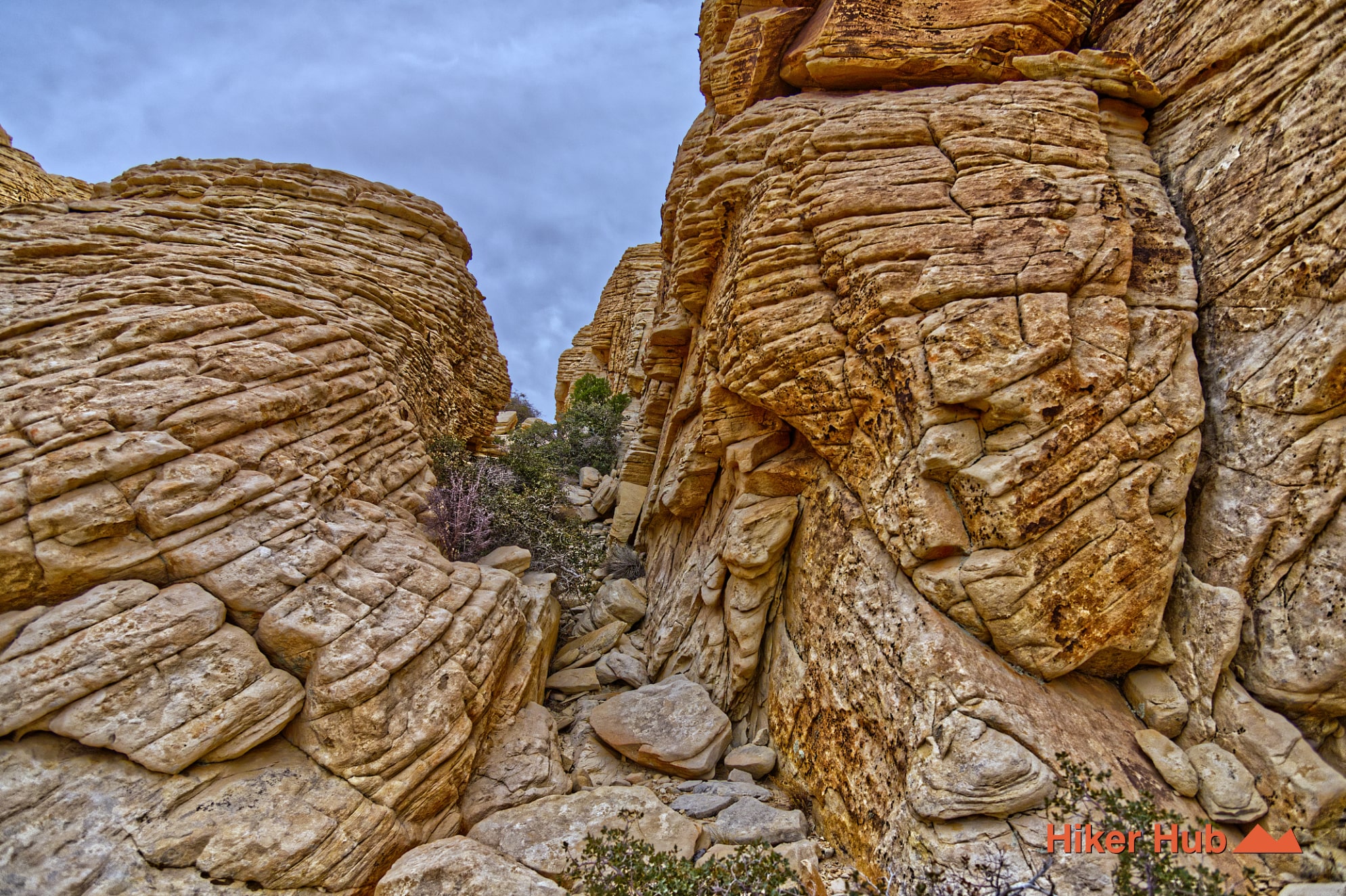
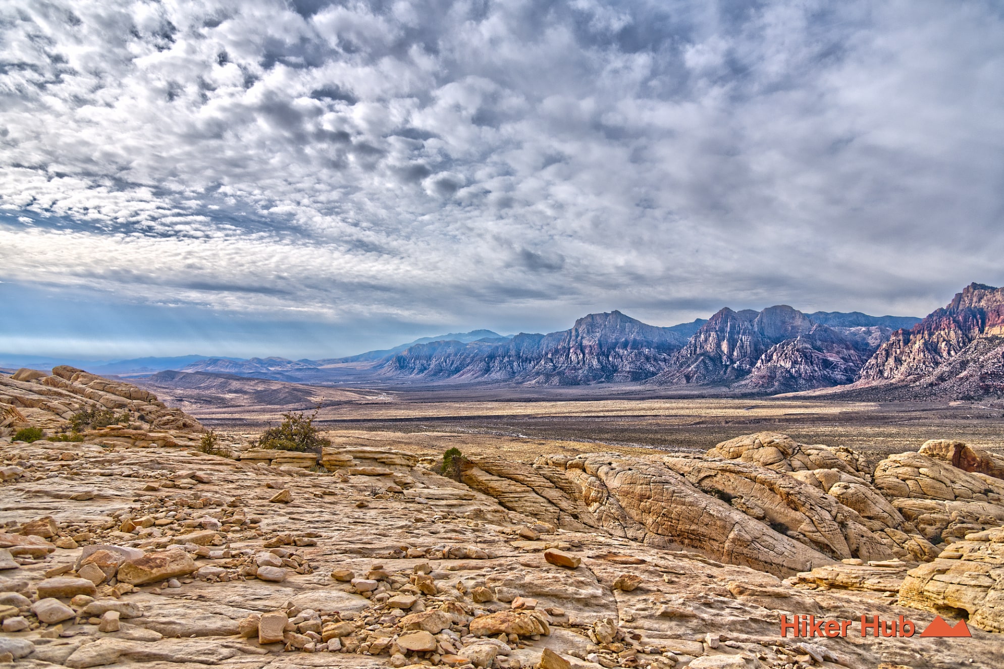
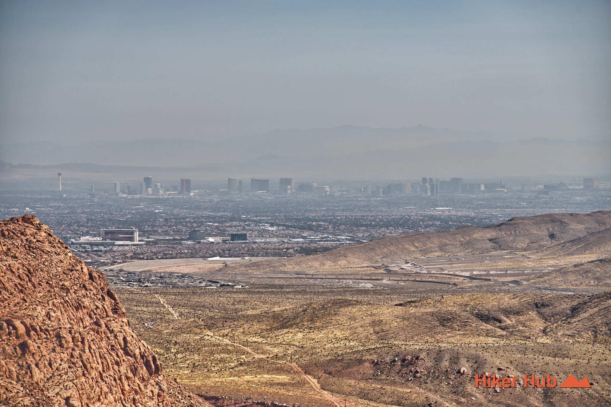
This unsanctioned route, commonly referred to as Red Cap, can be both confusing and unlike any other path in the area. To begin, head toward Calico Tanks, then veer left onto an unmarked corridor that climbs a deceptively mild-looking slope. The mountain appears easy from below, but the terrain quickly transforms into a maze of sandstone ramps, tilted slabs, and ledges. The ascent narrows into a tight, steep crevice where you’ll squeeze between massive boulders. You'll emerge onto open sandstone resembling the aftermath of a natural rockfall. As you gain height along the rim of the Calico Basin, Red Cap reveals sweeping panoramas—full views of The Las Vegas Strip, seasonal pools tucked into the rock, and over 270 degrees of uninterrupted scenery. Among hiking in Las Vegas, Red Cap is a unique adventure.
Because Red Cap is not a BLM-sanctioned trail, it doesn’t appear on official Red Rock Canyon National Conservation Area maps. Instead, it typically shows up in extraneous places as a “social route,” meaning it formed organically from repeated foot traffic rather than being intentionally built. This can cause confusion for first-time visitors. BLM-listed trails are formal routes maintained and monitored, while Google Maps trails for instance often include informal paths, scramble routes, and unnamed connectors. Of which are created by decades of hikers exploring the sandstone.
While Red Cap requires more route-finding and awareness than standard trails, exploring these miscellaneous “no-name” routes can be an excellent way to familiarize yourself with the park’s terrain. They reveal patterns of the land you wouldn’t notice otherwise. How washes connect, where sandstone transitions into loose gravel, and how ridges lead naturally into basins. Red Cap viewpoints nearly align with the surrounding mountains. These unmarked paths help hikers build a deeper sense of geography, allowing for more confident navigation across the massive Red Rock Canyon NCA trail system.
Red Cap isn’t simply a summit; it’s an immersive lesson in the landscape. For experienced hikers seeking a raw, hands-on adventure with some of the best views in the Calico Hills, this unsanctioned gem stands out as one of the most memorable experiences in Red Rock Canyon Las Vegas.
Recommended gear
Gear picks are matched to this route using distance, difficulty, terrain, and desert conditions.
Disclosure: some links may be affiliate links. Red Rock Hiker Hub may earn a commission at no extra cost to you.
Water carry
Useful for exposed desert routes where one small bottle is not enough.
View hydration packsSafety
Worth carrying for cactus spines, scrapes, blisters, and minor trail injuries.
View first aid kitsPhone backup
Useful when taking photos, checking maps, or spending a long day outside.
View power banksFooting
Better traction helps on loose gravel, sandstone, rocky washes, and steeper trails.
View trail shoesShade
Simple shade matters on open desert terrain, sandstone slabs, and long approaches.
View hiking hatsEarly / late starts
Cheap insurance if a route takes longer than expected or you start before sunrise.
View headlamps