Water carry
3L Hydration Pack
Useful for exposed desert routes where one small bottle is not enough.
View hydration packs4.16 miles • Moderate • Trail
Conditions, access, and regulations can change. Always verify current information and assess safety before visiting.
Offline maps coming soon. Be first to access downloadable routes.
Some listings may be paid partnerships.
Know a useful stop near this trail? Suggest a business
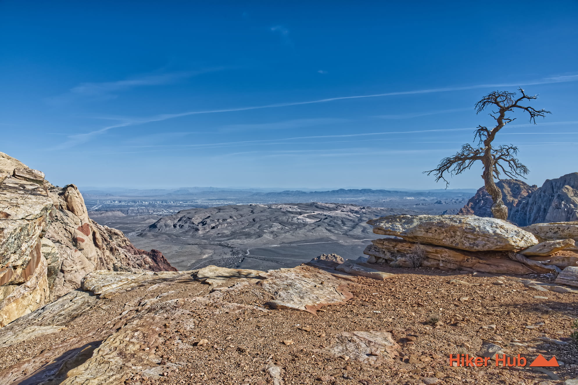
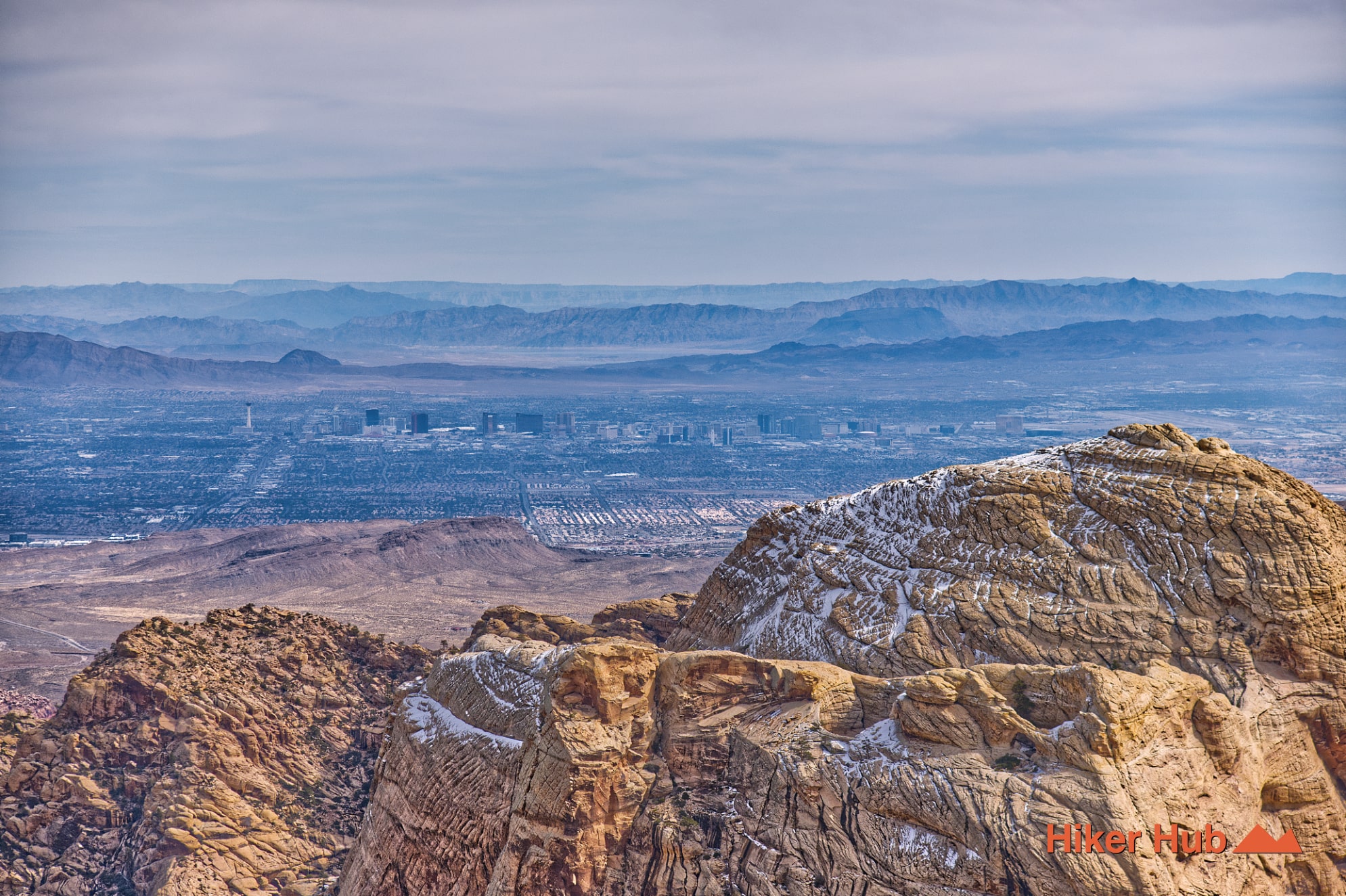
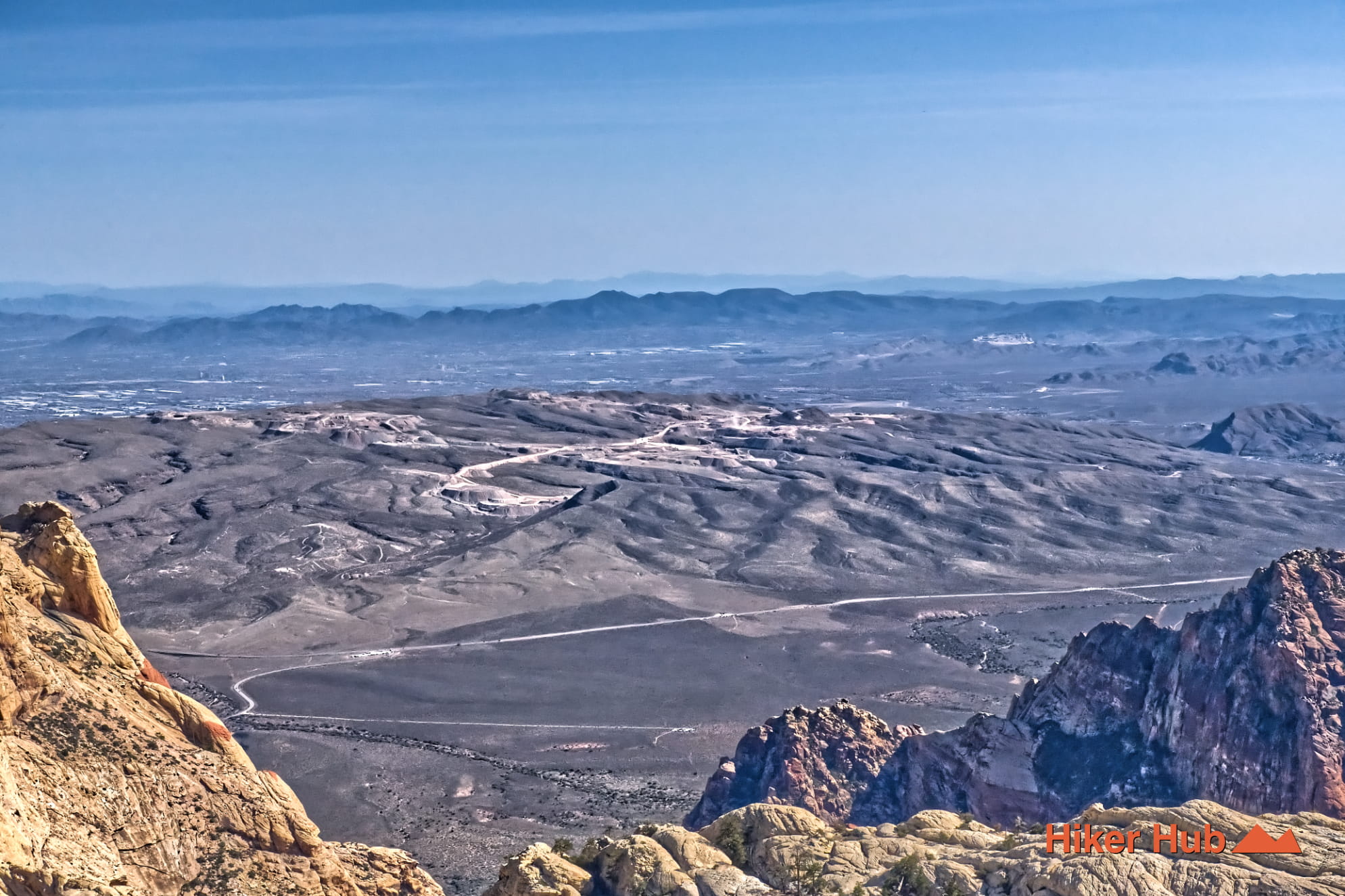
North Peak is a remarkable destination in Red Rock Canyon Las Vegas with an elevation of just over 7,000 feet. There are two entirely different ways to access this location. Each of which vary tremendously in both effort and alotted time. Regardless of which route you take, you'll be rewarded with wildly diverse, spacious, and distant views of The Strip and the Las Vegas Valley. The views from the North Peak Trail are expansive and unique—comparable in scale to Turtlehead Peak, yet offering a completely different vantage point.
The North Peak Trail is known as one of Red Rock Canyon’s tallest and most demanding hikes. There are two primary approaches to the North Peak Trail:
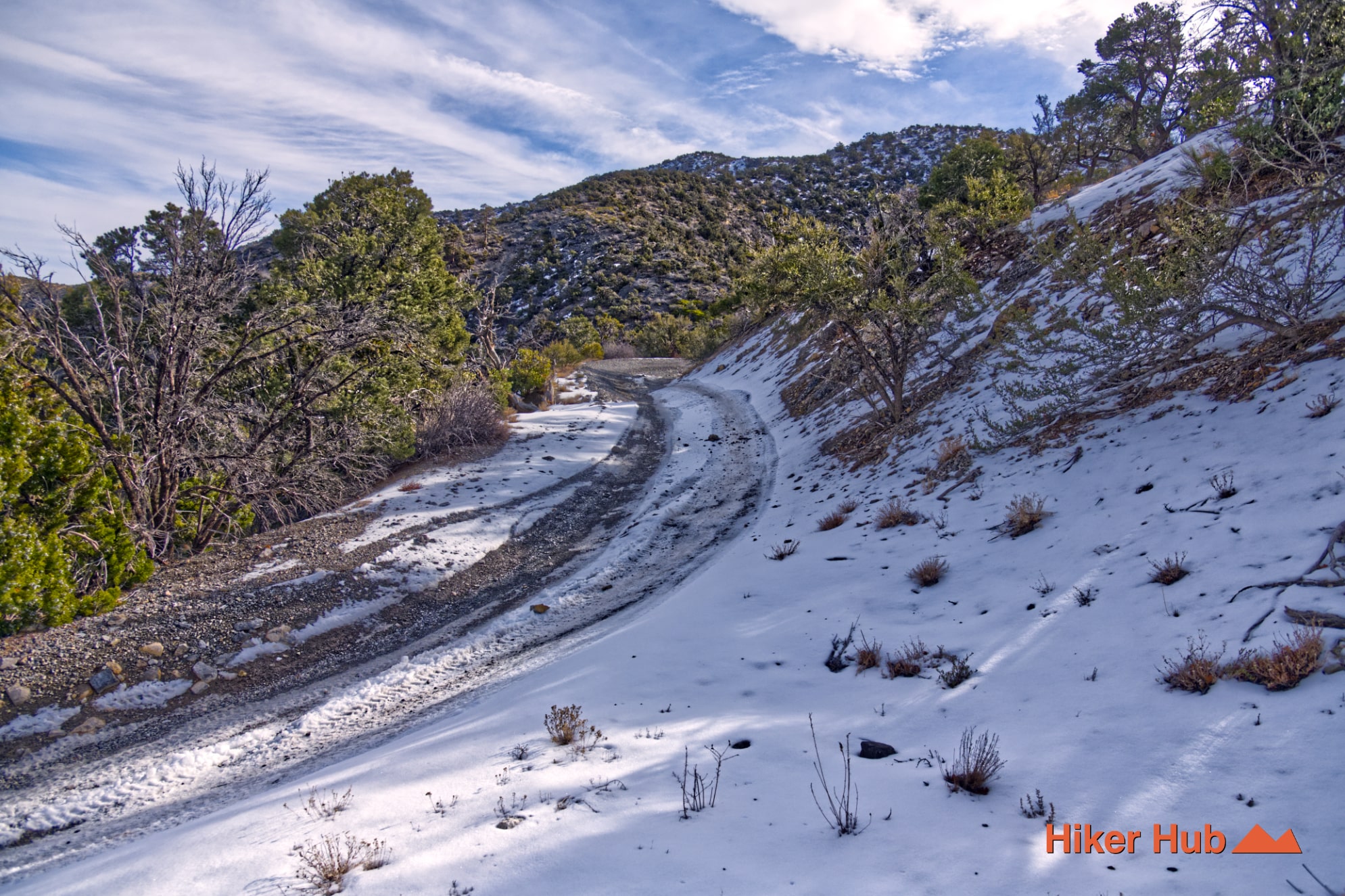
Rocky Gap Road is extremely treacherous, filled with mini boulders, large gaps, and serious off-road obstacles. There's even a section called the rock garden. This road cuts straight through the mountains and leads to the Lost Creek/ Willow Springs area. It’s suitable only for highly capable trucks, quads, or bikes operated by those familiar with advanced, rugged terrain. Do not underestimate challenges of this road—rocky sections can cause seriously expensive damage to vehicles.
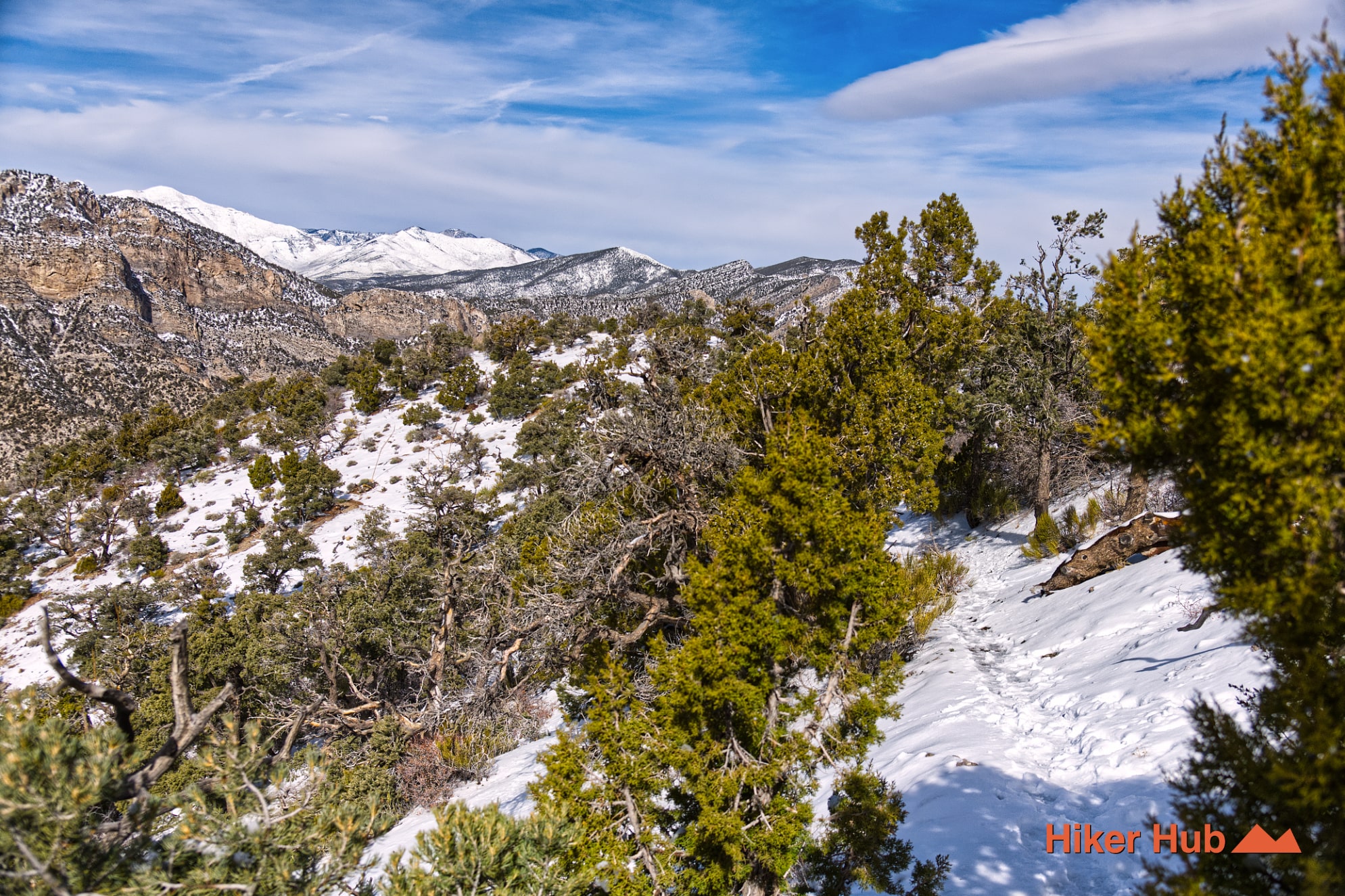
Approaching the North Peak Trail from Lovell Canyon is more straightforward, with numerous turnouts for parking and even camping. Overnight camping is permitted along Rocky Gap Road via the designated turnouts. Camping is not allowed from the scenic loop side. If you decide to camp in this region in an effort to perhaps reach North Peak by sunrise, you'll be presented with two additional potential hindrances.
The best option is reaching the peak anywhere between 7am - 4pm year round. This slot requires potentially hiking during dawn and dusk in the worst case scenario. Do bring a head lamp.
This is the other option—which is inaccurate as it takes much longer than an hour to reach the trailhead from the Scenic Loop.
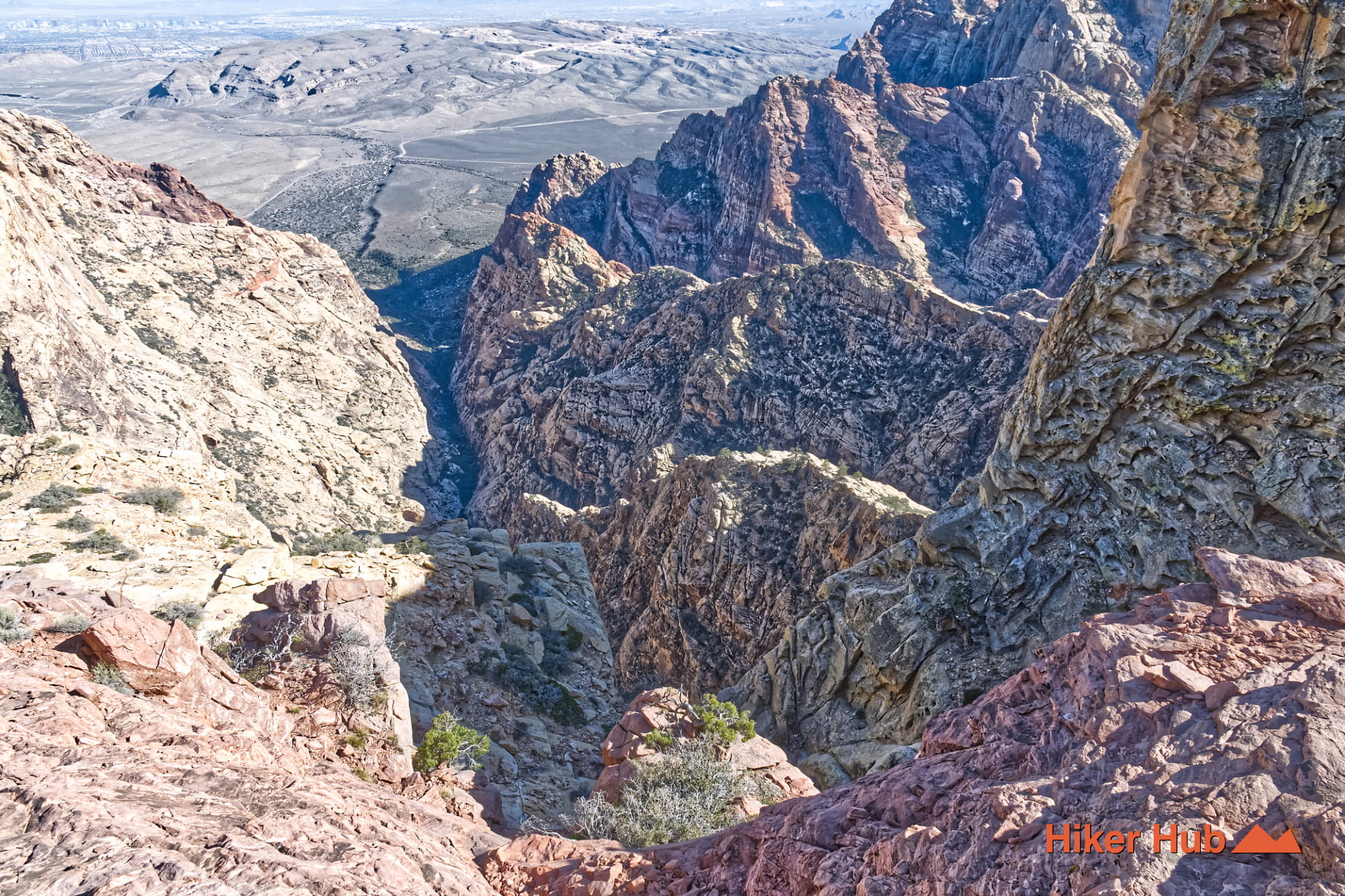
The North Peak Trail is often paired with Bridge Mountain, though the two hikes are vastly different in difficulty and navigation. North Peak can be somewhat easier to access thanks to established routes like the North Peak–Bridge Mountain Trail and visible trail markers higher up. Bridge Mountain, however, is notoriously difficult to reach; many hikers attempting to combine the two turn back due to navigational challenges, changing weather, or loss of daylight.
What you can do however, beyond North Peak, is hike partially to Bridge Mountain. There's extraordinary cliffs, and wildly amazing views of the Las Vegas valley. Roughly 45 minutes to an hour beyond North Peak is sufficient. This will give you ample time during daylight to comfortably explore multiple destinations.
The trail intelligence on this page reports the Lovell Canyon route. Hikers can drive to Lovell Canyon Rd, go quite deep in to the canyon itself, then turn on to Rocky Gap Road (trailhead map marker). This rough road gets progressively more difficult so depending on your vehicle, utilize the turnouts. Park, and hike the rest of the way up. With or without adding Bridge Mountain to the mix, you'll embark on one of the most notable hiking trails in Las Vegas.
Recommended gear
Gear picks are matched to this route using distance, difficulty, terrain, and desert conditions.
Disclosure: some links may be affiliate links. Red Rock Hiker Hub may earn a commission at no extra cost to you.
Water carry
Useful for exposed desert routes where one small bottle is not enough.
View hydration packsShade
Simple shade matters on open desert terrain, sandstone slabs, and long approaches.
View hiking hatsSun protection
A lightweight sun layer is one of the most useful pieces of gear for Red Rock exposure.
View sun hoodiesFooting
Better traction helps on loose gravel, sandstone, rocky washes, and steeper trails.
View trail shoesHeat support
Helpful on hot days, longer hikes, and steep routes where plain water may not be enough.
View electrolytesSteep routes
A good fit for longer routes, sustained climbs, loose descents, and knee-saving return hikes.
View trekking poles