Water carry
3L Hydration Pack
Useful for exposed desert routes where one small bottle is not enough.
View hydration packs2.23 miles • Moderate • Trail
Conditions, access, and regulations can change. Always verify current information and assess safety before visiting.
Offline maps coming soon. Be first to access downloadable routes.
Some listings may be paid partnerships.
Know a useful stop near this trail? Suggest a business
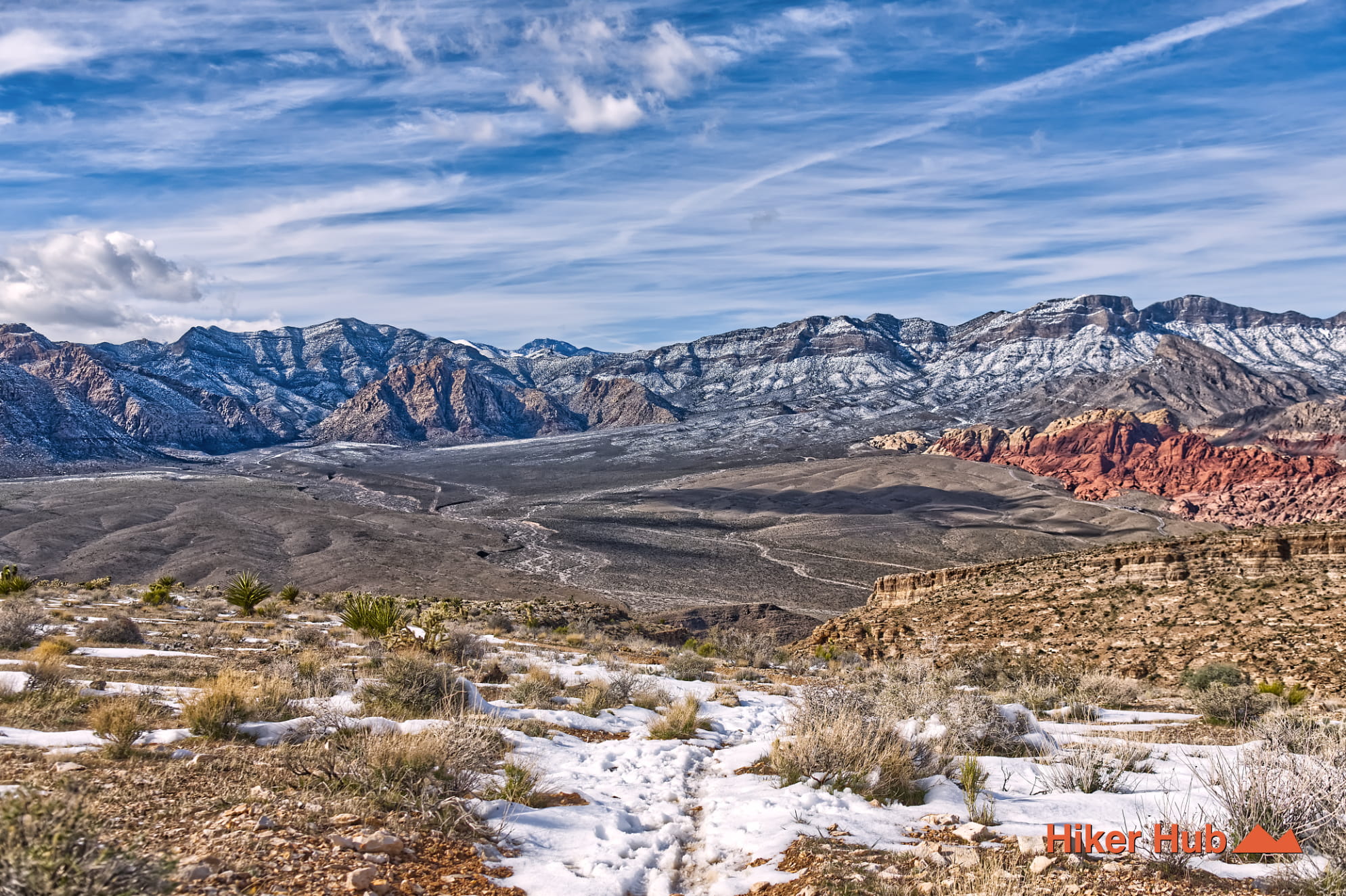
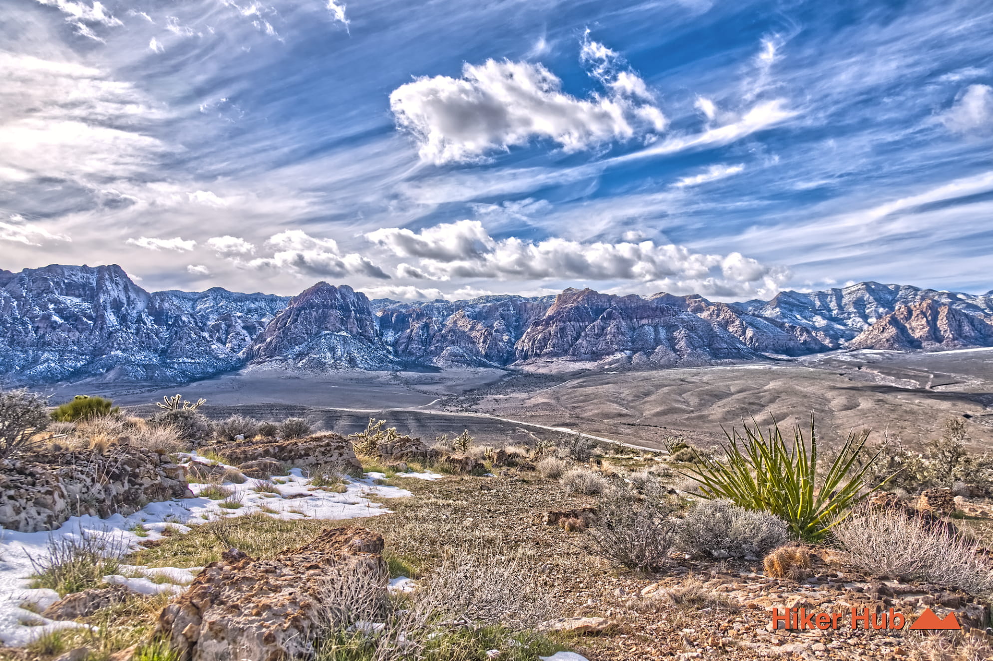
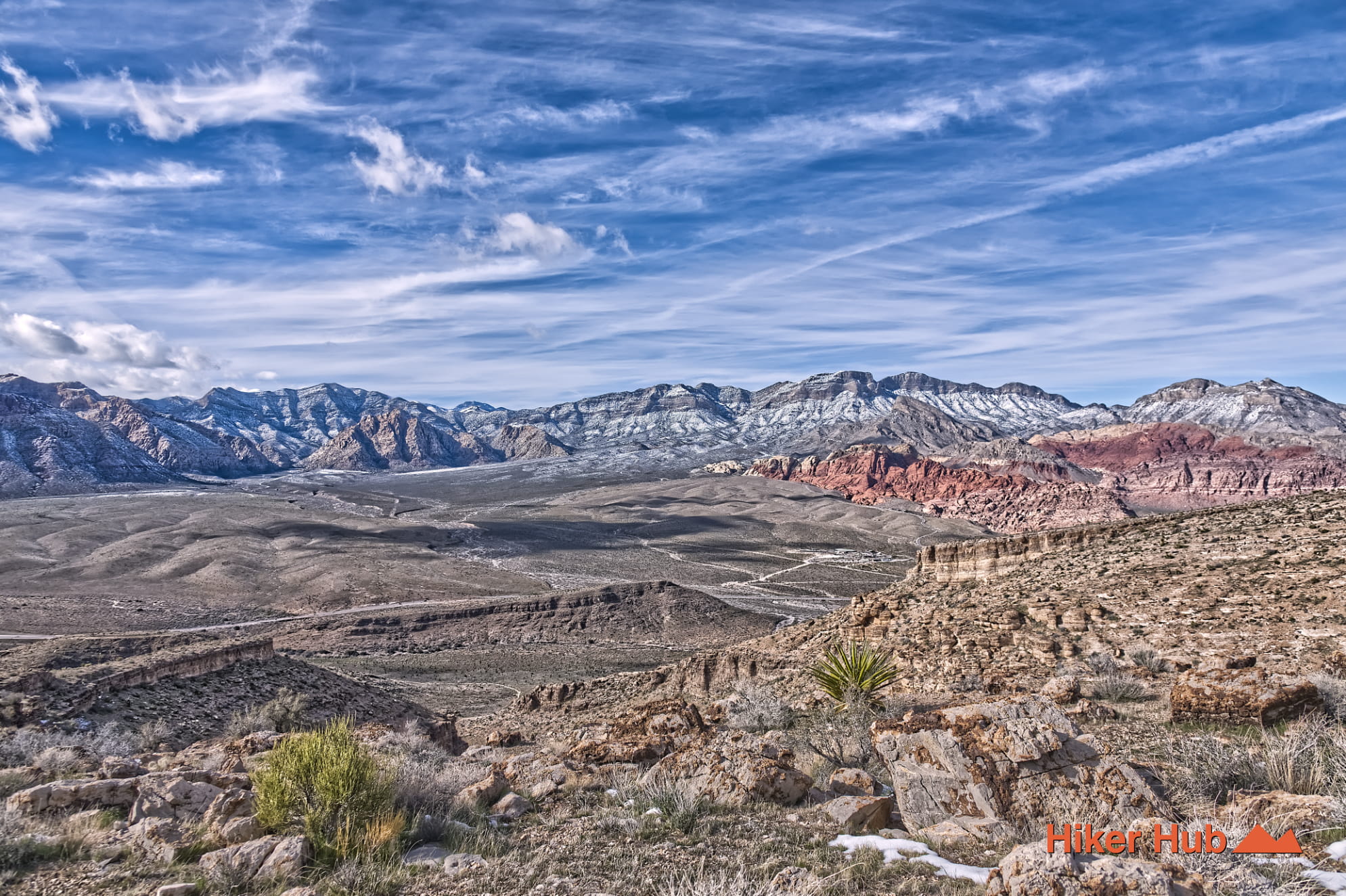
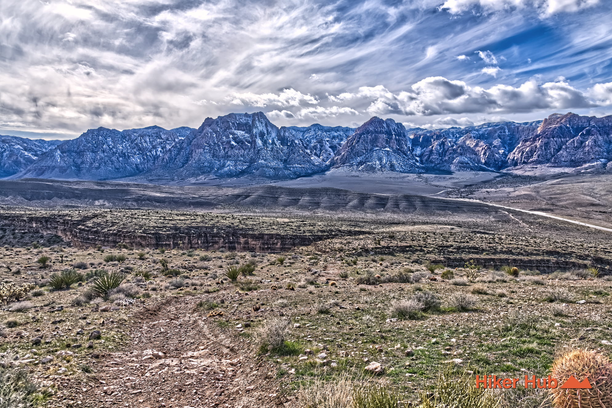
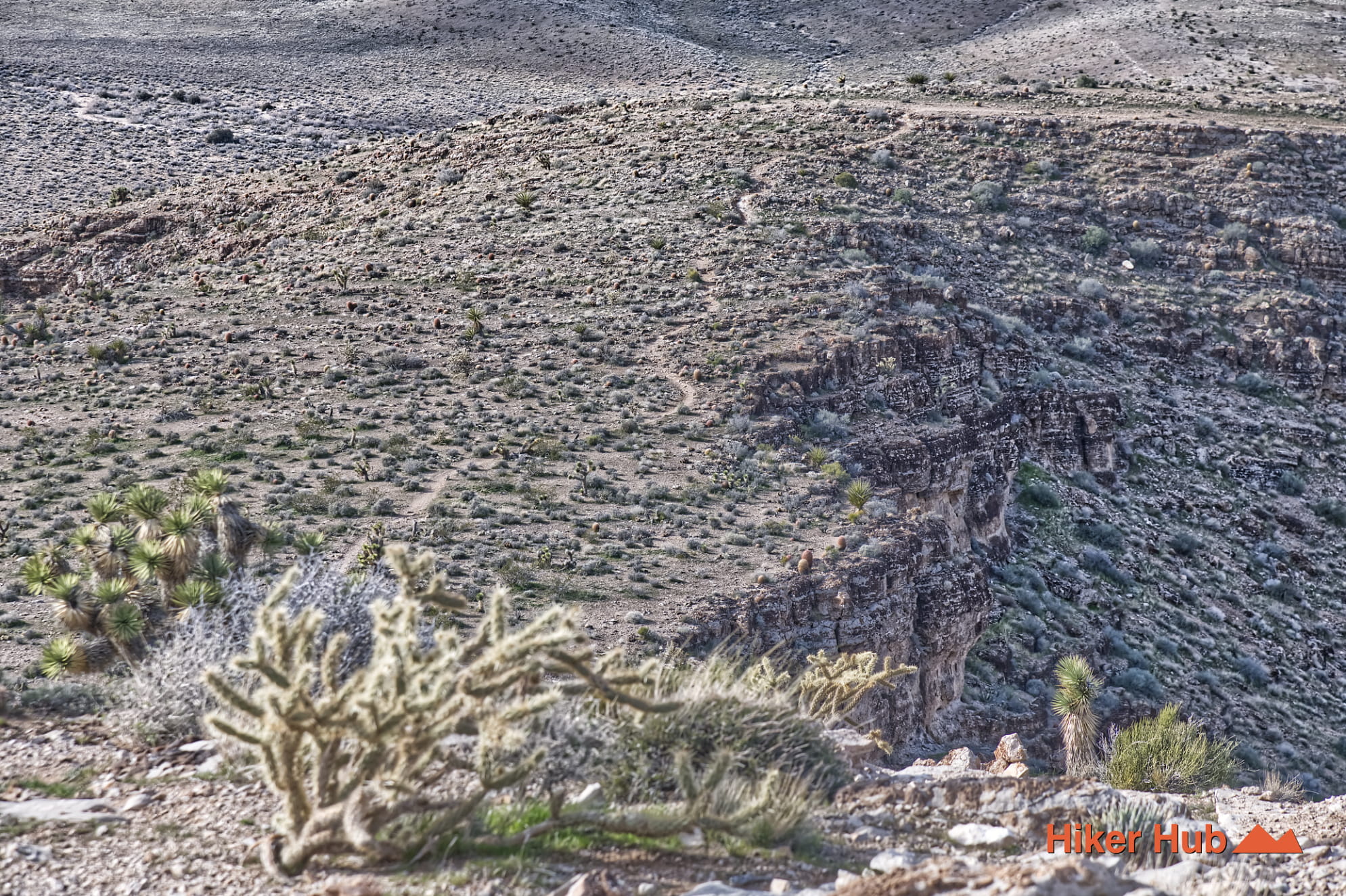
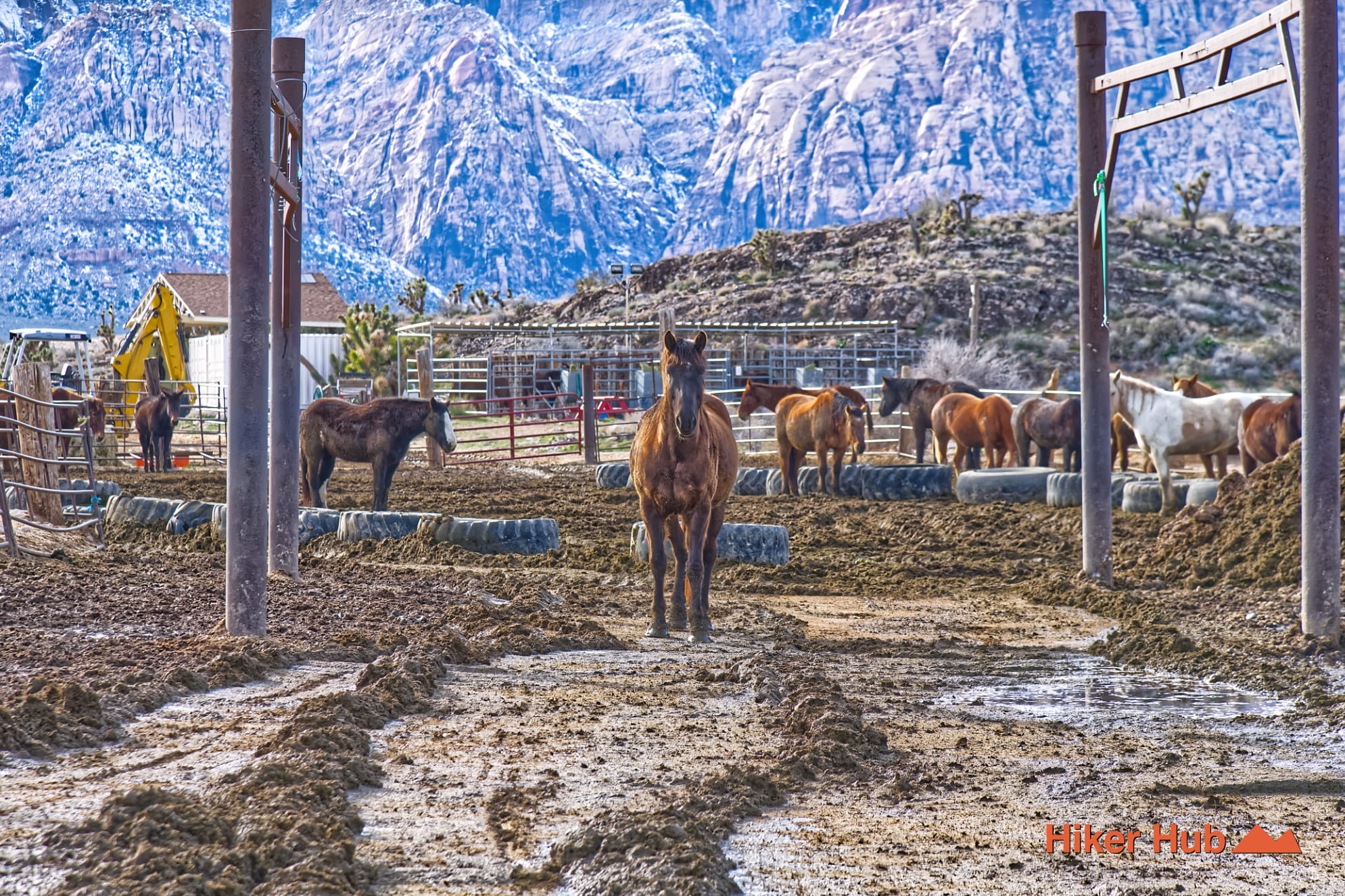
The Boneshaker trail in Red Rock Canyon National Conservation Area sounds more intimidating than it is. Yes, no doubt—it's a steep incline ascending for a slow 2.23 miles. It's no Mt. Wilson or Bridge Mountain though. Starting at roughly ground level just beyond the horse stables, it takes hikers and mountain bikers further up Blue Diamond Hill. Mountain bikers would probably enjoy riding down this picturesque trail vs pedaling up. Hikers may be starting this trail here with plans to catch the next connector. Either way, this trail is both challenging and possesses remarkable views of The Spring Mountains below.
All of these trails—Bob Gnarly, Boneshaker, Radio Tower, Cat in the Hat, Kibbles n' Bits, and many others in this region have near zero shade. They're all largely entirely exposed. Blue Diamond Hill is undoubtedly packed with wildly diverse trails ranging from direct to curvy, zig zag, and totally unpredictable. The views are unlike anywhere else nearby. There are no springs causing seasonal streams. What you will find however is seasonal snow which seems to disappear as quickly as it appeared. Blue Diamond Hill is indicative of rich, rugged, and untamed stereotypical Mojave style trails.
Though the Boneshaker is fully capable as being its own out and back, standalone trail—it's most definitely classified as a connector. One in which leads to the Radio Tower trail and SARS. Each of which have their own forks and connections. Though signage is minimal at most, there is one sign you may notice—a small white Red Rock Canyon National Conservation Area boundary sign. Foot traffic and even mountain bikers are few and far between. This region is the antithesis of the Scenic Loop in the most popular area of Red Rock Canyon Las Vegas. In turn, if it's solitude and minimal to no traffic, this is ideal.
As always, be very careful. Bring water and any necessary gear for the type of excursion, time of day, and season. Be fully prepared to bail yourself out of any and all mishaps that may occur in this unforgiving environment. You'll be largely on your own.
Recommended gear
Gear picks are matched to this route using distance, difficulty, terrain, and desert conditions.
Disclosure: some links may be affiliate links. Red Rock Hiker Hub may earn a commission at no extra cost to you.
Water carry
Useful for exposed desert routes where one small bottle is not enough.
View hydration packsShade
Simple shade matters on open desert terrain, sandstone slabs, and long approaches.
View hiking hatsSun protection
A lightweight sun layer is one of the most useful pieces of gear for Red Rock exposure.
View sun hoodiesFooting
Better traction helps on loose gravel, sandstone, rocky washes, and steeper trails.
View trail shoesSkin protection
Small, easy to carry, and useful on nearly every Southern Nevada trail.
View SPF essentialsSafety
Worth carrying for cactus spines, scrapes, blisters, and minor trail injuries.
View first aid kits